Telecom tower inspection
09.09.2022
GeoINOVA has all the necessary documentation for the execution of flying ventures, which includes a drone registration certificate, an insurance policy, and a pilot certificate.
Software for image processing is Pix4D, which enables precise results, simple analysis, and keeping documentation up-to-date. Some of the basic functionalities are: the creation of accurate 2D maps and 3D models from images; measuring distance, area, and volume; adding notes; generation of elevation profiles; conducting virtual inspections; and the possibility of sharing recordings with other interested parties. The specification is available via the link.
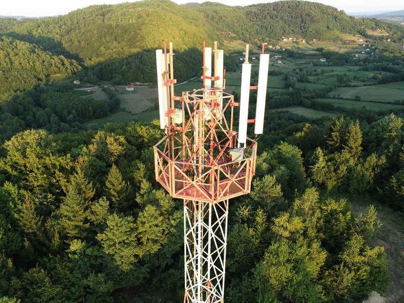
With the help of these technologies, that is, digital replicas, it is possible to obtain detailed information about the condition of hard-to-access objects of the telecommunications infrastructure, such as poles. Therefore, an up-to-date record of them has been obtained: the equipment that is installed and which space is available for rent.
The biggest advantages are: 75% faster data collection; automated asset inventory; cutting inspection time by 80%.
All news